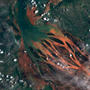
Copernicus Browser is a free Copernicus Browser satellite imagery viewer from the European Union that lets you check fires, floods, construction and destruction anywhere on Earth for yourself.
What This Resource Offers
Copernicus Browser satellite imagery comes from all Copernicus missions, including the Sentinel satellites, and you can search, view and download it at full resolution. Choose an area, a time range and a data collection, then switch between true color and other visualizations or build your own. You can make timelapses right in the browser and download raw data for deeper analysis.
How to Use This Resource
Zoom to your location, set a date range around the event you are checking and compare before and after images. Free Sentinel imagery is too coarse to show people, and clouds can hide a scene, so confirm findings with ground photos or news reports. Combine it with the Bellingcat Middle East Change Detection Map and the InVID Verification Plugin to check viral claims.
Who It Serves and Where
Copernicus Browser serves researchers, journalists, climate watchdogs and human rights investigators, with global coverage. It is part of the Copernicus Data Space Ecosystem, the Earth observation program of the European Union, built with the European Space Agency. Downloading data requires a free account. Find more tools like this in our OSINT Tools category.
Share this: