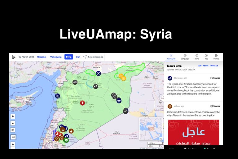
LiveUAMap’s Syria map is a real-time conflict monitoring platform that tracks military activity, airstrikes, armed clashes, protests, and territorial developments across Syria using a geolocated interactive map. Instead of relying on delayed news summaries, the site places reported incidents directly onto a map so users can see where events occur and how conflict zones change over time.
The platform aggregates open-source reporting, official announcements, and publicly available media, then organizes the information chronologically and geographically. This allows researchers, journalists, and analysts to follow developments as they unfold, identify active front lines, and observe patterns such as repeated airstrike locations, troop movements, or escalation in specific regions.
For investigative and educational research, map-based monitoring provides context traditional reporting cannotionally misses. Users can build timelines, compare events to diplomatic actions or international statements, and track how local incidents connect to larger geopolitical strategies. When paired with verified reporting and official documentation, monitoring maps help reconstruct sequences of events and evaluate competing claims about what occurred.
Because it aggregates open-source information, the platform should be used as a situational awareness and research tool rather than a single verified authority. Its strength lies in visualization and documentation — preserving fast-moving developments that might otherwise be scattered across many sources.
In simple terms: it lets you watch a conflict geographically, not just read about it afterward.