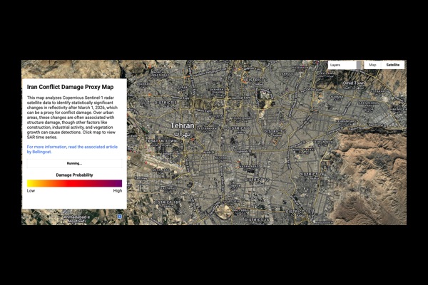
The Bellingcat Middle East Change Detection Map is an advanced open-source investigation tool that uses satellite imagery and geospatial analysis to identify potential damage and environmental changes across conflict zones in the Middle East. Built using Google Earth Engine and Copernicus Sentinel-1 radar data, the platform highlights statistically significant shifts in surface reflectivity, which can indicate destruction, infrastructure damage, or other ground-level changes over time.
This tool is designed to support journalists, researchers, and citizen investigators by making complex satellite data accessible and actionable. Instead of requiring specialized technical skills, users can visually explore areas of interest and quickly identify where meaningful changes have occurred. This significantly reduces the time and expertise needed to analyze large-scale geospatial datasets.
The platform is part of Bellingcat’s broader commitment to open-source intelligence and transparency. By providing free access to powerful investigative tools, Bellingcat enables independent verification of events in regions where traditional reporting may be limited or restricted. These tools are especially valuable in environments affected by censorship, internet shutdowns, or conflicting official narratives.
Because the map relies on radar satellite data, it can detect changes even through cloud cover or during nighttime conditions. This makes it a reliable resource for monitoring active conflict zones where optical imagery may be unavailable or delayed.
Overall, the Bellingcat Middle East Change Detection Map transforms raw satellite data into a practical investigative resource. It strengthens accountability efforts by helping users track damage, verify claims, and better understand rapidly evolving situations on the ground.