Represent this organization? Request to claim this listing and suggest verified updates.
All claims require manual verification and approval. No editing access is granted automatically.
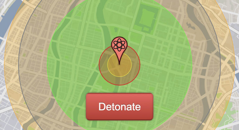
NUKEMAP is a free nuclear weapon effects map that shows what a nuclear detonation would do to any city on Earth, turning abstract megatons into rings of fire, blast and radiation you can see over your own neighborhood.
What This Resource Offers
Created by nuclear historian Alex Wellerstein in 2012, this nuclear weapon effects map lets you pick any location, choose a historical or modern warhead or set your own yield, and select an airburst or surface burst. It draws the fireball, blast overpressure rings, thermal radiation and ionizing radiation zones, with optional fallout plumes, crater size, mushroom cloud dimensions and humanitarian impact estimates. Detonations can be exported to Google Earth or saved as CSV files for research and teaching.
How to Use This Resource
Drag the target marker or search for a city, select a preset weapon, then press Detonate to see the effect rings. Turn on casualty and fallout options for the full picture, and read the explanation of each ring so you understand what the numbers mean. The results are models, not predictions, so review the methodology notes on the site before citing any figures. Pair it with The Doomsday Clock for context on current nuclear risk, Physicians for Social Responsibility for disarmament advocacy, and In Time of Emergency for preparedness guidance.
Who It Serves and Where
NUKEMAP serves students, teachers, journalists, researchers and peace activists worldwide, and works for any location on the map. It is built by Alex Wellerstein, a historian of science at Stevens Institute of Technology, with support from Ploughshares Fund and Stevens. Find more tools for disarmament and peace work in our Peace and Anti War category.